Applicability
Maps are required to demonstrate the project is located within a certain distance from amenities and features located outside of the building site.
General Requirements
When providing maps, ensure that the areas that confirm compliance are highlighted and/or annotated.
Information Checklist
- Visual representation of the project and a larger context (e.g. site, campus or city).
- Annotations to indicate the amenity’s location and required information.
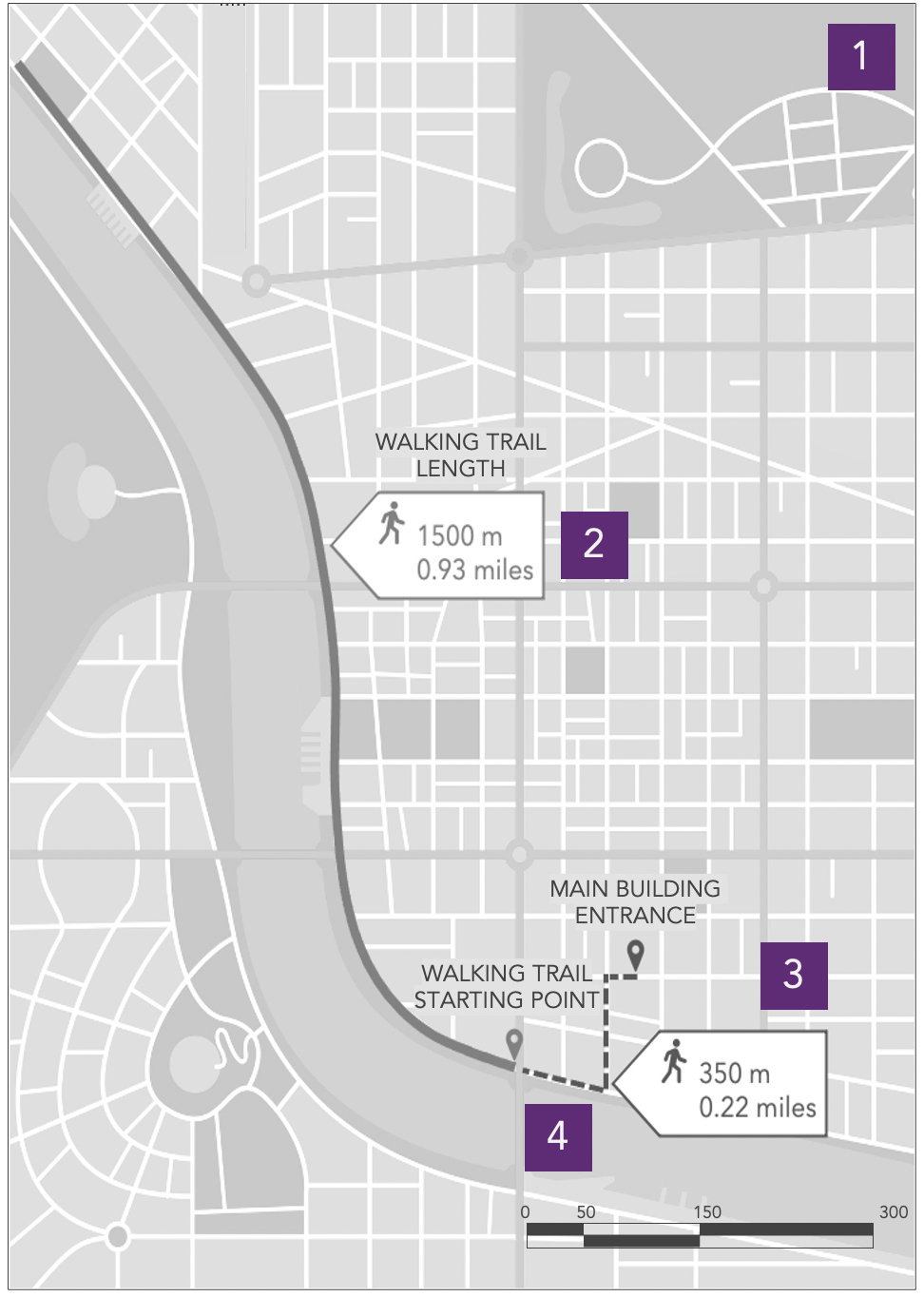
- Annotations to indicate project’s location and main building entrance.
- Indication of walking route and distance between the main building entrance and the required amenity.
Guidance and Insights
- The documentation provided may include as many maps as necessary in order to demonstrate compliance.
- Maps may be in any language, provided they include notes with translations to English.
- Hand drawings and writing may be accepted, provided they are legible and translated to English.
- Distance measurements must be walking routes. Driving, radial, non-pedestrian routes, and minutes-in-place-of-distance may not qualify.
- Screenshots of Google Maps or other similar services may qualify, provided the documentation includes all required information and/or annotations to confirm compliance.
- Maps, aerial images, and floor plans may be used interchangeably, provided the selected document includes all required information to confirm compliance.
- Scale should be commensurate with information shown.
Samples

Sample Documentation for map representation
WP Strategy 3.2: Provide regular occupants access to an outdoor walking trail
Comments
0 comments
Please sign in to leave a comment.